English · Bahasa Indonesia
Plugins I have built for GeoLibre (by Qiusheng Wu, opengeos/GeoLibre, DOI Wu (2026)) and QGIS (QGIS Development Team, qgis/QGIS). The platforms belong to their authors; the plugins are mine.
How they work together
Usage
Counts come straight from the GeoLibre plugin registry every time this page opens.
GeoLibre plugins
Try them right here: GeoLibre runs inside this page.
GeoLibre running in this page. Open Plugins → Marketplace and install Layout Composer, GBIF Data, or iNaturalist Extractor to try it here, or open it full screen.
Layout Composer
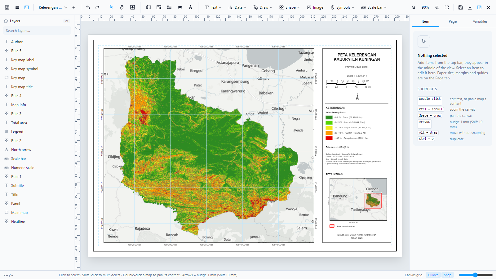
Figure 2:The Layout Composer workspace in GeoLibre.
A cartographic layout designer for GeoLibre: print-ready maps with layers, grids, insets, legends, and export.
Official page · Full README · Repository · Read the guide
GBIF Data
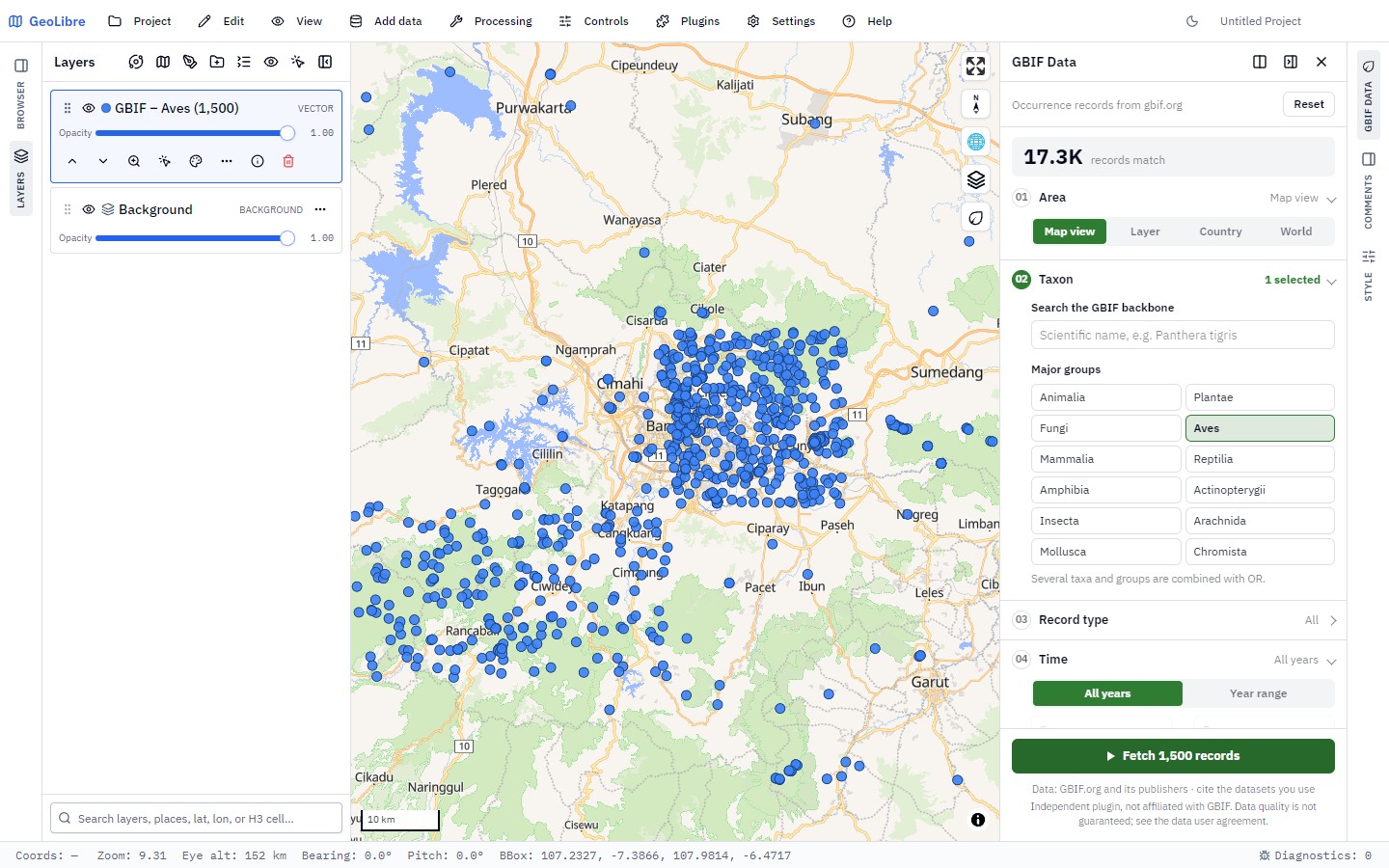
Figure 3:GBIF occurrences shown as points.
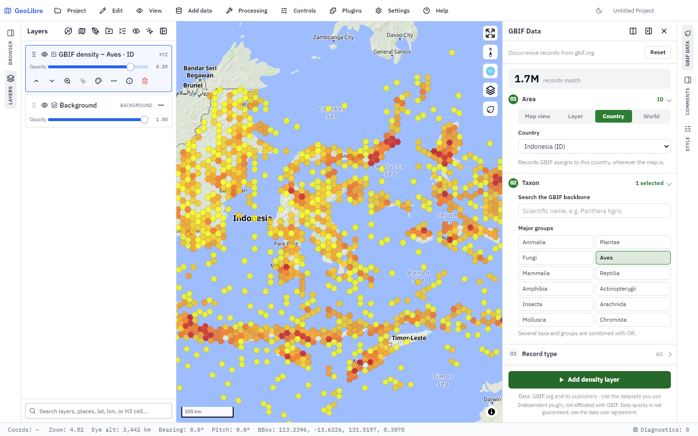
Figure 4:GBIF occurrences shown as a density layer.
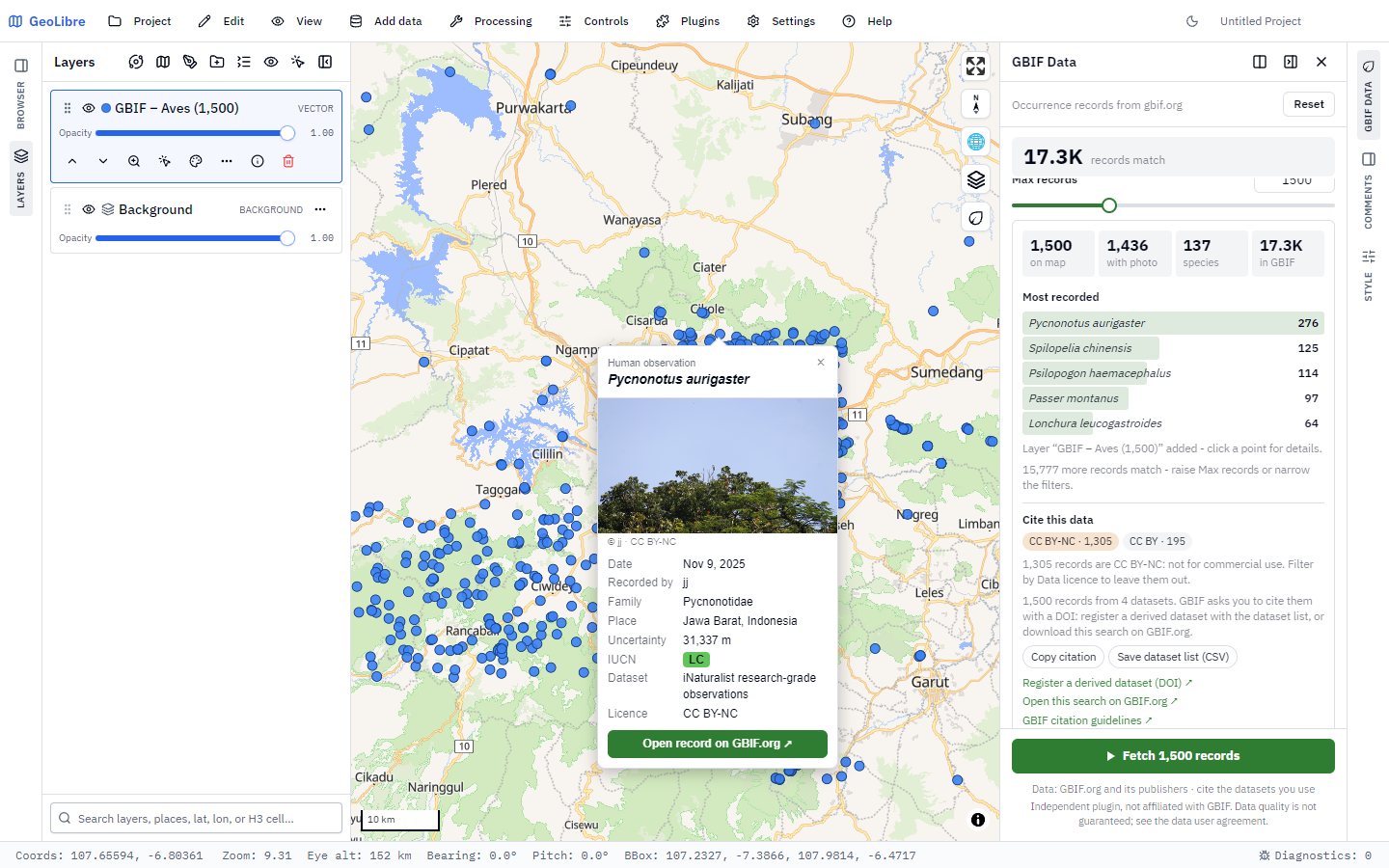
Figure 5:A record popup with its citation.
Fetches occurrence records from GBIF straight onto the GeoLibre map.
Official page · Full README · Repository · Read the guide
iNaturalist Extractor
Fetches iNaturalist observations and adds them to the map as a GeoJSON layer.
Official page · Full README · Repository
About GeoLibre
GeoLibre is not my software. It is created and maintained by Qiusheng Wu (ORCID 0000-0001-5437-4073), University of Tennessee, Knoxville, under the opengeos organisation, and released under the MIT License. I contribute plugins to its ecosystem (the plugins on this page).
GeoLibre is a free, cloud-native GIS that runs in the browser, on the desktop, on mobile, and in Jupyter notebooks, with 1,000+ geoprocessing tools running on WebAssembly. It is built with Tauri, React, TypeScript, MapLibre GL JS, DuckDB-WASM, and deck.gl.
| Author | Qiusheng Wu |
| Repository | github |
| Website | geolibre.app · User guide · Tutorials |
| Plugin marketplace | plugins |
| Related | geolibre-rust (WebAssembly tools), geolibre-r (R interface), plugin template |
| License | MIT |
| DOI | Wu (2026) |
How to cite GeoLibre
From the project’s CITATION.cff and citation guide:
Wu, Q. (2026). GeoLibre: A lightweight, cloud-native GIS platform for visualizing, exploring, and analyzing geospatial data (Version 3.6.1) [Computer software]. Zenodo. Wu (2026)
@software{wu_geolibre_2026,
  author    = {Wu, Qiusheng},
  title     = {GeoLibre},
  year      = {2026},
  version   = {3.6.1},
  publisher = {Zenodo},
  doi       = {10.5281/zenodo.20785400},
  url       = {https://github.com/opengeos/GeoLibre}
}QGIS plugins
RasterViz
Scientific, Matplotlib-style raster visualization in QGIS without coding, used by 1,300+ users.
Official QGIS page · Full README · Repository · Documentation site
qthresh
Live, slider-driven threshold preview for raster layers in QGIS.
- Wu, Q. (2026). GeoLibre. Zenodo. 10.5281/ZENODO.20785400