Tutorial singkat untuk mengunduh peta tutupan lahan MapBiomas Indonesia menggunakan Google Earth Engine (GEE) dan mengekspornya ke Google Drive (GeoTIFF).
AOI ditentukan dari geometry yang digambar langsung di GEE
https://
Tahun data fleksibel (tersedia sejak 1990) Ganti kode classification_2024 menjadi classification_1990, 2000, 2010, dst termasuk nama variabel yang terdapat tahun var TutupanLahan = PL_MapBiomas.select(‘classification_2024’);
🔗 Link Google Earth Engine Code
https://
🌐 Referensi Resmi MapBiomas
Website: https://
landy .mapbiomas .id /en Web Map (GUI): https://
platform .indonesia .mapbiomas .org
🗺️ Kode Google Earth Engine
// Load MapBiomas Indonesia Collection 4
var PL_MapBiomas = ee.Image(
'projects/mapbiomas-public/assets/indonesia/' +
'lulc/collection4/' +
'mapbiomas_indonesia_collection4_coverage_v2'
);
// AOI dari geometry yang DIGAMBAR di GEE
var AOI = geometry;
// Pilih tahun tutupan lahan
// Ganti classification_2024 menjadi classification_1990, 2000, 2010, dst
var TutupanLahan = PL_MapBiomas.select('classification_2024');
// Clip ke AOI
var TutupanLahanClip = TutupanLahan.clip(AOI);
// Kelas & palet warna
var Kelas = [3,5,76,13,40,35,9,21,30,24,25,31,33,27];
var PaletWarna = [
'1f8d49','04381d','2f7360','d89f5c','c71585','9065d0',
'7a5900','ffefc3','9c0027','d4271e','db4d4f','091077',
'2532e4','ffffff'
];
// Remap untuk visualisasi
var TutupanLahanRemap = TutupanLahanClip.remap(
Kelas,
ee.List.sequence(0, Kelas.length - 1)
);
// Tampilkan peta
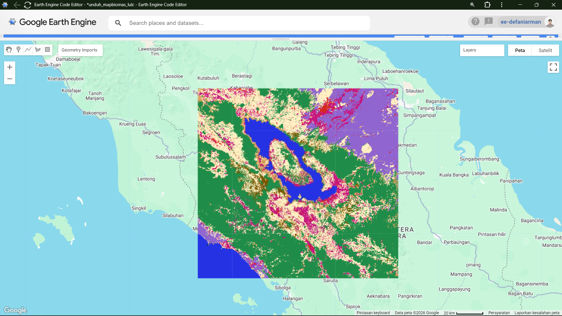
Map.centerObject(AOI, 5);
Map.addLayer(TutupanLahanRemap, {
min: 0,
max: Kelas.length - 1,
palette: PaletWarna
}, 'Tutupan Lahan MapBiomas');
// Export ke Google Drive
Export.image.toDrive({
image: TutupanLahanClip,
description: 'MapBiomas_Indonesia_2024',
folder: 'MapBiomas',
region: AOI,
scale: 30,
crs: 'EPSG:4326',
maxPixels: 1e13,
fileFormat: 'GeoTIFF'
}); **Export**
https://